


Bicycling and mountainbiking in Bozen / Bolzano, South Tyrol
Bicycling & mountainbiking in Bozen / Bolzano and vicinity
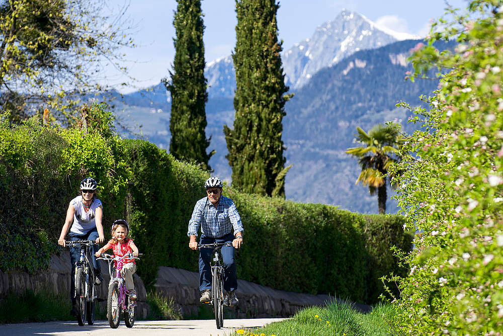
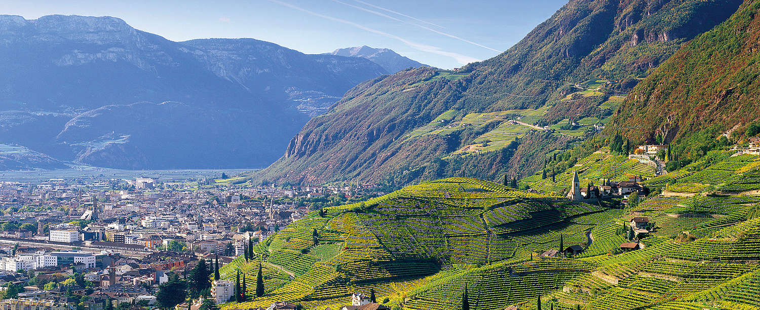
Simply hop on your bike and peddle through the constantly changing scenery – That's bicycling in Bozen / Bolzano and vicinity. From Leifers / Laives, you can take an easy bike ride along the Etsch / Adige River, to Garda Lake, or to Bozen / Bolzano or Meran / Merano. Give it a try! And then take a rest with us at the Hotel Steiner.
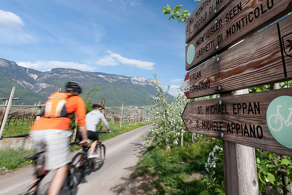
Starting as early as March, the first bikers can be seen on the famous passes in the South of South Tyrol. The Mendel Pass, Gampen Pass, the Nons / Non Valley, the San Lugano Pass, the Fleims Valley / Val di Fiemme, the Cembra Valley are all great touring options. In Eppan / Appiano, Kaltern / Caldaro, and Tramin / Termeno a total of 600 km of trails crisscross the forests – truly an Eldorado for mountainbikers open for bikers starting in mid-April.
Rent a bike.
We rent E-Bikes for € 20,00, City-bikes for € 15,00 and Kids-bikes for € 10,00. We also rent helmets, child seats or kids trailer for bikes. Get your free bike tour info at the front desk.
Bicycle tour to Bozen / Bolzano
This tour will take you from the train station in Leifers / Laives via the Bahnhofstrasse to the Marconistrasse and on towards Pfatten / Vàdena. Turn in to the bike trail to Bozen / Bolzano and then continue till you reach the center of the provincial capital!
By bike to Lake Garda
The entire route, from the bicycle path to Garda Lake, has a length of 105 km and can be completed in five hours. The bicycle trail is level or only slightly hilly, so that even beginners shouldn't have a problem.
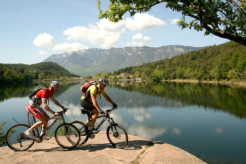
Montiggler Lake Trails with the mountainbike
There are a number of fine trails threading their way through the Montiggler Woods. There are a few challenging ascents, a couple of segments that require technical prowess, but many of the trails otherwise offer smooth hiking across fields and along forest paths. And don't forget your swim suits for a cool dip at the end!
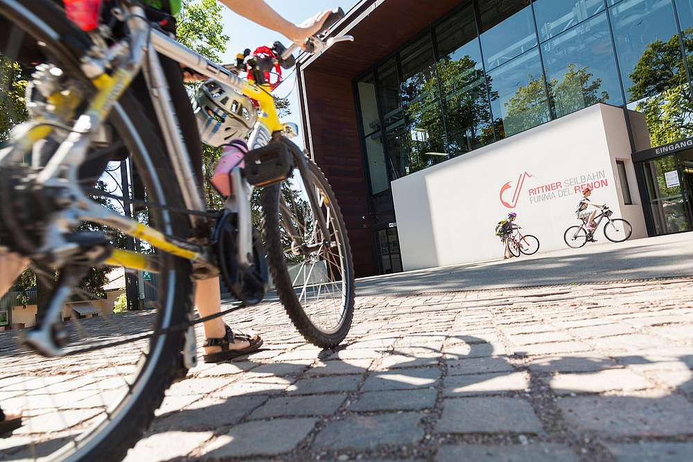
Bozen aerial cableway tour with the mountainbike
From Bozen / Bolzano, there are three different aerial cableways that bikers can use to reach the freeride tours. The "classic" tour among DH routes is definitely Kohlern / Colle, where bikers from far and near can be found. Oberbozen / Soprabolzano - Ritten / Renon features root passages, serpentines, and breathtaking views of the Dolomites. And Jenesien / San Genesio Atesino offers an idyllic trail & flow tour which has yet to gain much notoriety.
At the Tourism Agency in Leifers / Laives, you can obtain the loan of bicycles and electric bikes.
Hiking in Bozen / Bolzano and surroundings
Hiking vacation in South Tyrol
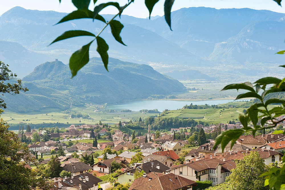
In the Unterland of South Tyrol, just a few kilometers from the provincial capital, you'll find South Tyrol's youngest city. To the west, Leifers / Laives borders the lake region of the Überetsch / Oltradige Valley. To the east, there's the UNESCO World Nature Heritage Site of the Dolomites. And in the north, it borders Bozen / Bolzano. Leifers / Laives thus offers a wide variety of hiking options throughout the year.
The Breitenberg is the city's trademark. This mountain features numerous hiking routes, so that you can explore the vicinity of the Hotel Steiner:
Hiking suggestion: Via the Breitenberg to the Wölflhof and from there to Deutschnofen / Nova Ponente
Hiking time: approx. 3.5 hours
Altitude differential: approx. 1,100 m
A steep but very rewarding trail. From the Steinerhöfe double farmsteads, you are afforded a magnificent panoramic view of Leifers / Laives and the Unterland of South Tyrol.
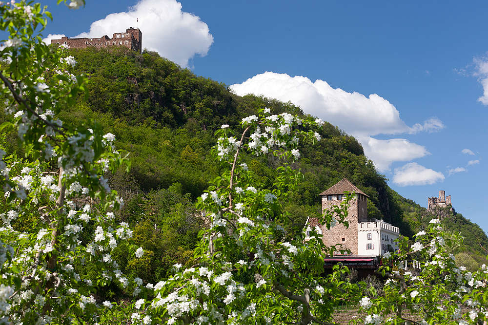
Another hiking highlight is the old pilgrims' trail from Leifers / Laives to the baroque monastery of Maria Weissenstein. This is the best-known place of pilgrimage of South Tyrol, and was visited in 1988 by the Pope:
Hiking suggestion: Pilgrim's Trail to Maria Weissenstein
Hiking time: approx. 4 hours
Altitude differential: approx. 1,260 m
During the ascent – along which you'll come across numerous religious shrines – you'll have a fabulous view of South Tyrol's Unterland. Proceed through the wooded Branten Valley, along the Branten Brook, to Deutschnofen / Nova Ponente (approx. 3.5 hours), a charming alpine village with a terrific panoramic view of the surrounding mountains. If you want, you can return with the scheduled bus.
You can hike from the Hotel Steiner and the vicinity all year round. Exploring the great outdoors along the countless hiking trails in and around Leifers / Laives is a pure pleasure.
Hiking suggestions for Bozen / Bolzano & vicinity:
The Leifers High-Altitude Trail:
Hiking time: approx. 6 hours
Length: 18 km
Altitude differential: approx. 1050 m
The Leifers High-Altitude Trail offers a variegated hiking experience, but it is in part challenging, and is recommended only for those who have a firm footing and don't suffer dizziness.
Starting from the Hotel Steiner / Camping Park, proceed to the village square (2nd traffic light). Once there, turn left into the valley, proceed past the church and proceed about 4 km along the road into the Branten Valley until you come to the brook crossing and reach the Gasthof Zur Mühle. Up to here, the road is asphalted. You'll pass under the conveyor line of an abandoned fluorite mine. Trail No. 12 ascends steeply to the north. After about 10 minutes, you'll reach the beautifully situated Gasthof Schwabhof (approx. 700 meters). After a short ascent, a somewhat narrow, but reinforced path will lead you through the sunny porphyry walls of the Branten Valley. You'll come to a magnificent viewing point (approx. 900 meters) with railing where you can enjoy a view encompassing the entire Etsch / Adige Valley. A broad trail lying in the shade of chestnut trees leads you past the Hocheggerhof to the Brunnerhof and then to the two Steinerhof farmsteads, which features a chapel. You'll need roughly 2 hours from the Schwabhof to here. From here, you can take Trail No. 11 and descend to Leifers / Laives in approx. 1 hours. From the Steinerhof farmsteads, the trail continues level for a while and then takes you into the gorge of the Steinmann Brook.
A forest road takes you below and past the Alplerhof to the Altebnerhof and then to the Gasthof Rechtebner and to Seit (868 m). From the Steinerhof farmstead to here takes about 1.5 hours. Below the little church in Seit - this section of Leifers / Laives which can also be reached via a very good road from Neu-Steinmannwald - Trail No. 3 begins. This trail carved out of porphyry will take you in 1.75 hours to the ruins of Haselburg (where you can stop for refreshments) and in another 15 minutes to Haslach (BZ). From here, you can take the Line 2 bus back to the start.
Around the Breitenberg (the village trademark), continue past the prehistoric settlement of Trensbirg (where only a few ruined walls remain). From the Hocheggerhof, you can enjoy a fabulous view!
We recommend planning this hike for the spring or autumn.
Burgenweg Boymont–Korb–Hocheppan
Total hiking time: 3.5 hours
Starting-point: St. Pauls, Korb Castle (P)
Starting from the parking lot at Korb Castle, follow the asphalt road until you come to the signpost for the Burgenweg. This trail will now take you up through a deciduous forest until you come to the ruins of the Boymont Castle. The trail then leads along a secured but in part steep wooden climbing staircase to the Hocheppan Castle. From here, you can start your return hike, on past the forest and vineyards, along the road to the Korb Castle.
Altenburg – Panorama Trail
Total hiking time: 3 hours
Total length: approx. 3 km
Starting-point: Kaltern / Caldaro-Altenburg (P) by the inns
Amidst the idyllic alpine forest, there's an almost completely level roundtrip trail that will take you along the high-altitude plateau via Kaltern / Caldaro and Tramin / Termeno. It affords a view over Lake Kaltern / Lago di Caldaro, the Etsch / Adige Valley, all the way down to the Salurner Klause. Besides the panoramic trail, it's possible to take a side-trip to the ruins of St. Peter in Altenburg. It is believed that structure dates back to the 6th century. In addition to the magnificent view of Lake Kaltern / Lago di Caldaro, you can see a pagan sacrificial site.
Trudner Horn Nature Park
The Trudner Horn Nature Park is famed for its flora and fauna. It has the largest number of species of all nature protection areas in South Tyrol. The Nature Park has an area of 6,866 hectares and borders the communities of Altrei / Anterivo, Montan / Montagna, Neumarkt / Egna, Salurn / Salorno, and Truden / Trodena.
Hint: Hike from Truden to the Cisloner Alm: A beautiful panoramic view of the Unterland of South Tyrol and the Mendel Ridge.
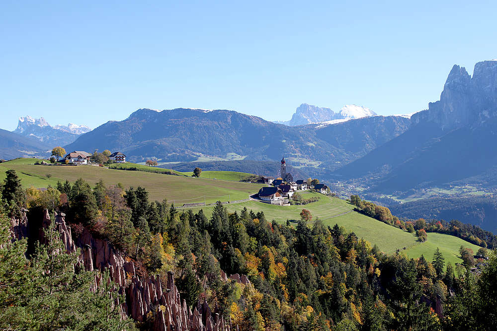
Hike to the "Earth Pyramids" at the Ritten / Renon
Total hiking time: approx. 3 hours
Total length: approx. 11.8 km
Altitude differential: 270 m
From Bozen / Bolzano, you can take the Ritten / Renon cableway to Oberbozen / Soprabolzano. You can continue your trip to Klobenstein / Collalbo with the more than 100-year-old narrow-gauge railway. From there, you can hike towards the "Earth Pyramids" and follow the signpost "Fenn Promenade." The trail will take you through a shady mixed forest until you come to the Kommendehof. From here, follow the marking "Earth Pyramid Trail." You can already see the Earth Pyramids on the right side of the valley. The return trip is along the same route.